Language Icon
Welcome Image
Using open source software for a wide range of geospatial activities has never been easier, with a wide variety of tools available. Couple this with the huge increase in availability of open data from many sources and there is no longer any need to rely on the changing policies of proprietary vendors.
Open Street Map
As an active participant in the Open Street Map (OSM) community I can help in maximising use of the vast global database that the community has created. From extracting data to making it work in combination with other data sources to create new spatial datasets. I am also a member of the Open Street Map Foundation and encourage all those with an interest in maintaining an open world map to give their support to the foundation's work.
OSM Image
Data Visualization
Using open source web mapping libraries such as Leaflet it need not be very complex to produce custom built webmaps and other interactive visualizations from open data statistics. I can also help with data analysis of open data sources in Spain and other countries. Talk to me about your requirements.
OS Geoimage
Services Image

Take advantage of the open data and open source software ecosystem to overcome those old problems of modifying proprietary software to meet your specific needs or having to pay for essential datasets that were only in private hands.

Open Source Geospatial
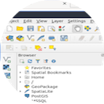
There have been very significant developments in open source geospatial tools in recent years. With a desktop GIS like QGIS it is now possible to perform most of the tasks often associated with commercial GIS products. Combine this with the spatial data storage and modelling capabilities of PostGIS, and the different options available for serving maps to the web, and get the full benefits and flexibility of these community developed tools.
Telco Image

Thank you for visiting, here are the contact details if you want to get in touch:

Red Baobab SL
Calle Cruz Verde 24, 2º izda,
28004 Madrid,
SPAIN

Email: info@redbaobab.com